
how to estimate frost risk: what the calculation measures and when to use it
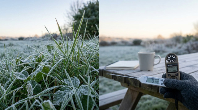
The phrase "how to estimate frost risk" refers to a practical calculation that predicts whether conditions overnight are likely to produce frost on surfaces (ground, plants, vehicles). This estimate combines the forecast air temperature, dew point (or relative humidity), wind speed and site characteristics to assess if surface temperature will drop to 0°C (32°F) or below. Use this method for garden protection, agriculture planning, protecting exposed pipes, or preparing vehicles.
key variables and the basic concept behind frost formation
- Air temperature (T_a): forecast or observed temperature near ground level (°C or °F).
- Dew point (T_d): temperature at which the air becomes saturated and water condenses; closely related to humidity.
- Wind speed (u): low wind favors radiational cooling and stronger ground-level cooling; measured in m/s or mph.
- Sky cover: clear skies allow more radiative heat loss; cloudy skies reduce frost risk (qualitative adjustment).
- Site factors: cold-air pooling (valleys), elevation, soil moisture and vegetation cover affect surface cooling.
frost risk index: a simple formula to estimate likelihood
Use the Frost Risk Index (FRI) described below as a practical numeric indicator. It is not a meteorological certainty but a decision tool. The formula:
FRI = (T_a - T_crit) + alpha * (T_a - T_d) + beta * u + S
Where:
- T_a = night minimum air temperature (°C)
- T_crit = critical temperature for frost (0°C for general frost; adjust lower for radiational frost risk if needed)
- T_d = dew point temperature (°C)
- u = wind speed near ground during night (m/s)
- alpha = humidity weight (suggested 0.6)
- beta = wind weight (suggested 1.5)
- S = site sky/terrain adjustment (see table below)
Interpretation rule (recommended):
- FRI < -2 : High frost risk (very likely surface reaches 0°C or below)
- -2 ≤ FRI ≤ 1 : Moderate frost risk (possible; take protective measures for sensitive plants)
- FRI > 1 : Low frost risk
why the formula works
T_a - T_crit measures how close the air is to freezing. (T_a below 0 gives negative term favoring frost). (T_a - T_d) is the dew point depression: small values mean air is near saturation and radiative cooling can more easily bring surfaces to their dew/frost point. Wind speed increases mixing with warmer air aloft, reducing surface cooling—however, in some cases light wind can still allow strong cooling; beta is positive here to penalize higher winds (increase FRI, reduce frost likelihood). S is an adjustment to account for clear sky/valley effects.
site adjustment (S) values
| Condition | S (°C equivalent) |
|---|---|
| Clear sky, open plain | -1.5 |
| Clear sky, valley/cold-air pooling | -2.5 |
| Partly cloudy | 0 |
| Cloudy or windy exposed site | +1.0 |
| Heavy vegetation/snow cover (reduces cooling) | +0.5 |
step-by-step: how to perform the frost risk calculation manually
- Obtain forecast minimum air temperature (T_a) for the night and the forecast dew point (T_d). Use local weather station, app or forecast model.
- Measure or obtain forecast wind speed near ground (u) for the night. If measured in km/h, convert to m/s by dividing by 3.6. If in mph, 1 mph ≈ 0.447 m/s.
- Choose T_crit. For most practical frost decisions use 0°C (32°F). For sensitive crops you may choose different thresholds (e.g., -1°C).
- Select alpha = 0.6 and beta = 1.5 (defaults). Adjust slightly for local experience.
- Determine S from the site adjustment table based on cloud cover and terrain.
- Compute FRI = (T_a - T_crit) + 0.6*(T_a - T_d) + 1.5*u + S.
- Compare FRI to thresholds: FRI < -2 (high risk), -2 to 1 (moderate), >1 (low).
worked examples with real numbers
example 1 — high risk, calm clear night
Inputs: T_a = -1.5°C, T_d = -1.0°C, u = 0.5 m/s, clear sky open plain (S = -1.5), T_crit = 0°C.
FRI = (-1.5 - 0) + 0.6*(-1.5 + 1.0) + 1.5*0.5 + (-1.5)
FRI = -1.5 + 0.6*(-0.5) + 0.75 - 1.5
FRI = -1.5 -0.3 +0.75 -1.5 = -2.55
Result: FRI < -2 → high frost risk. Action: protect sensitive plants and exposed pipes.
example 2 — marginal, cloudy with light wind
Inputs: T_a = 1.0°C, T_d = -1.0°C, u = 1.8 m/s, partly cloudy (S = 0), T_crit = 0°C.
FRI = (1.0 - 0) + 0.6*(1.0 +1.0) + 1.5*1.8 + 0
FRI = 1.0 + 0.6*2.0 + 2.7 = 1.0 +1.2 +2.7 = 4.9
Result: FRI > 1 → low frost risk. Action: no protection needed for most plants, but monitor microclimates.
example 3 — valley with near-freezing temp and high humidity
Inputs: T_a = 0.2°C, T_d = -0.1°C, u = 0.8 m/s, valley cold-air pooling (S = -2.5).
FRI = (0.2 - 0) + 0.6*(0.2 + 0.1) + 1.5*0.8 -2.5
FRI = 0.2 + 0.6*0.3 +1.2 -2.5
FRI = 0.2 +0.18 +1.2 -2.5 = -0.92
Result: FRI between -2 and 1 → moderate frost risk. Action: consider light protection for sensitive crops.
how to use an online frost risk calculator
1) Open a frost risk or microclimate calculator (search for "frost risk calculator" or use Calculatorr's tools). 2) Enter forecast minimum temperature, dew point or relative humidity, and wind speed. 3) Select site settings (clear/cloudy, valley/plain). 4) Run the calculation to get a numeric FRI and recommended risk category. 5) Use results to decide protective actions.
Calculatorr provides weather-related calculators and guides that can simplify these steps; check related tools at Calculatorr for quick inputs and adjustments.
interpreting results and practical actions
- High frost risk (FRI < -2): Cover plants, use frost cloths, bring potted plants inside, run irrigation for frost protection where appropriate, insulate exposed pipes.
- Moderate risk (-2 to 1): Monitor conditions closely, prepare covers and water sources, delay planting or transplanting sensitive crops.
- Low risk (> 1): Regular precautions usually suffice; consider microclimate hotspots that may still freeze (low spots, near drains).
common errors and how to avoid them
- Using daytime temperature: always use forecasted minimum overnight temperature.
- Ignoring dew point: low dew point depression (T_a ≈ T_d) increases frost likelihood even if air T is slightly above 0°C.
- Overlooking microclimate: a station reading may not reflect a garden in a low-lying or sheltered spot—apply site adjustment S carefully.
- Assuming wind always reduces risk: very light winds can still allow strong surface cooling; use measured values not averages distant from ground.
customizing the method for sensitive crops or equipment
For crops with damage thresholds below 0°C, set T_crit to the crop-specific critical temperature (for example, -1°C or -2°C) and re-run the FRI. For frost-sensitive seedlings, treat FRI thresholds conservatively (e.g., consider FRI < 0 as actionable).
final tips for reliable frost protection decisions
- Check short-term forecasts and local observations just before nightfall; conditions can change rapidly.
- Use multiple nearby stations or sensors to confirm microclimate behavior.
- Combine numerical FRI with practical measures: covers, water, wind machines for orchards, and heat sources only when necessary.
Estimating frost risk with a simple index helps prioritize protective actions without needing advanced meteorology. Use the formula, adjust parameters to local experience, and rely on tools like Calculatorr to streamline inputs and decisions.